Tips
Direct to the field...
How to coordinate properly?
You must coordinate by 20nm from the boundary (radar) or 15 minutes procedural on non-LOA routes.
A yellow hotline opens a connection immediately to the requested controller.
A blue coldline requires the requested controller to accept the call.
You do not need to press any PTT button - just start talking.
*Hotline from TAS to SNO*
TAS: "via FLIKI JST802"
SNO: "JST802 FL340"
or
*Hotline from SAN to MDE*
SAN: "QFA829 reduce to 250 knots"
MDE: "250 knots QFA829"
or
*Coldline from MDE to TW TWR*
TW TWR: "Tamworth"
MDE: "Estimate, QLK1D, via MATLA, Tamworth at 04, assigned 9000 number 1"
TW TWR: "QLK1D 9000"
or
*Coldline from MK TWR to TBP*
TBP: "Tabletop"
MK TWR: "Taxies VOZ1175 for Brisbane, via MAGRA"
TBP: "VOZ1157"
or
*Hotline from MK TWR to TBP*
MK TWR: "Next, VOZ1157"
TBP: "VOZ1157 climb to FL180"
MK TWR: "FL180 VOZ1157"
How to be a flow controller with vatSys?
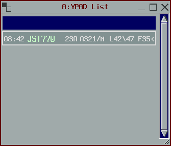
- If you click to the right of aircraft type in the arrival strips window, that’s the global ops field which is also shared between vatsys clients.
- Flow will write in there
L38\42 23A F15<meaningOriginal Landing Time/Sequenced Landing Time, rwy/approach, Feeder Fix time.<denotes that the time was entered by ENR control. - You just use a table of standard times from each fix which is normally published in LI’s and could be put into a spreadsheet and maintained by VATPAC.
- You order the strips below the bar with number 1 at the bottom.
Jake says “Thats how we flowed Adelaide which is probably as busy as VATSIM ever gets. Gives flow something to do other than sit there like a dog watching tv.”

Procedural Controlling with vatSys
vatSys has a bunch of tools that are designed to make controlling procedurally easier.
Whenever an aircraft is not identified, select the “Short Route Probe” through the Tools menu or using the keyboard shortcut Num *

When a pilot gives a position report, record everything by using the strip.
- Time at fix passed
- Current level (below cleared level)
- Estimate for next fix

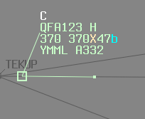
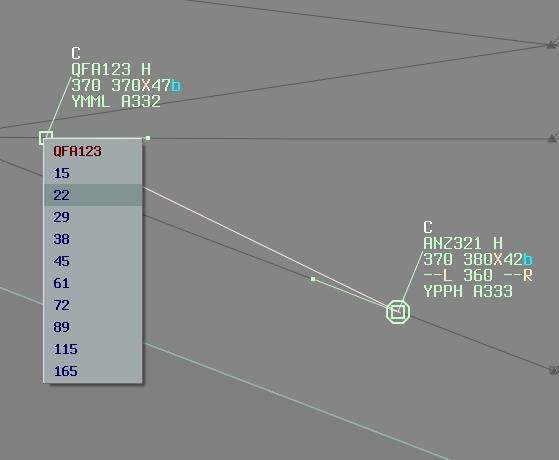
All estimates are shared between vatsys clients. You do not need to record times elsewhere. Conflict Area Tool can be used to determine the area that two aircraft are in lateral conflict. Select one track and click on the other. The drop down values are the combined navigation tolerance of each aircraft + 1 NM for separation (refer to MATS for tolerances).

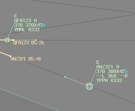
In this example, a value of 22 was chosen (7NM CEP + 14NM CEP + 1NM Separation). The conflict area is shaded and times of entry and exit are shown. You can use the BRL to measure from a relevant waypoint and get the pilot to report at that distance to establish clear of the area (or use it as a requirement for a change of level).

